Get to know La Atalaya
La Atalaya is a well-preserved natural environment to the north of the city centre of Ciudad Real. Several geographical factors make La Atalaya a clear example of Mediterranean scrubland and a unique space in the surroundings of the capital. For more information, discover below the factors that form La Atalaya and enjoy it through the senses and cultural, environmental and scientific knowledge.
DELIMITATION and TOPOGRAPHY
La Atalaya is a mountain that is related to the rest of the Calatrava territory, its character is defined by several authors as an “island”, “natural island” or “island-mountain”, this characteristic is specific to the transition zone between the region of Campo de Calatrava and La Mancha. The concept of “island” is caused by the uplift of the quartzite materials of the Hercynian socket, above the Tertiary and Quaternary materials that form the plain. For this reason, the materials that appear in La Atalaya are mainly the Armorican quartzites of the Lower Arenigian (Ordovician) and the Quaternary materials of the Pleistocene-Holocene (gravels, pebbles and quartzite blocks), which form the colluvium.
GEOLOGY and GEOMORPHOLOGY
La Atalaya is a mountain that is related to the rest of the Calatrava territory, its character is defined by several authors as an “island”, “natural island” or “island-mountain”, this characteristic is specific to the transition zone between the region of Campo de Calatrava and La Mancha. The concept of “island” is caused by the uplift of the quartzite materials of the Hercynian socket, above the Tertiary and Quaternary materials that form the plain. For this reason, the materials that appear in La Atalaya are mainly the Armorican quartzites of the Lower Arenigian (Ordovician) and the Quaternary materials of the Pleistocene-Holocene (gravels, pebbles and quartzite blocks), which form the colluvium.
VEGETATION
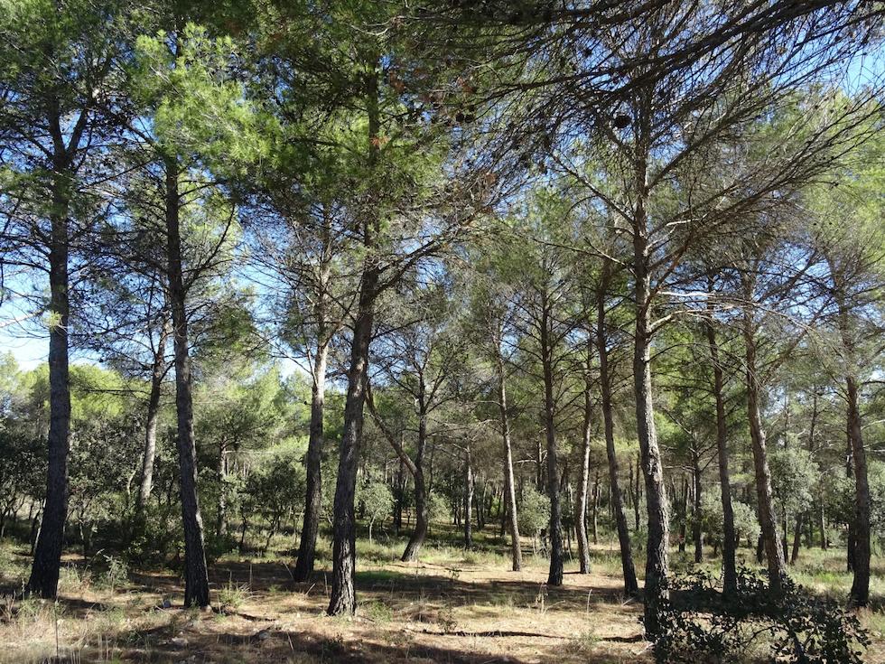
La Atalaya has a type of vegetation similar to that found in mountain systems such as Montes de Ciudad Real, Montes de Toledo or Sierra Morena. This serrezuela is one of the most extensive patches of Mediterranean woodland in the immediate surroundings of Ciudad Real. The phytosociological series that predominates in this mesomediterranean climate is that of holm oak groves with a dry ombroclimate of the Luso-Extremaduran subprovince, where there are associations of holm oak, broom, kermes oak, kermes oak, cress, rockrose and grassland, which in some degraded areas of the La Atalaya mountain were replaced by reforestations of pinaceae (Pinus halepensis and Pinus pinaster), cypress and eucalyptus. These processes and some more positive or negative ones have developed the garrigue and the forest of the main mountain, and 352 spermatophyte species have been identified, including some crops.
FAUNA
La Atalaya also acts as a “biogeographical island” in terms of fauna, as this mountain range is isolated in its delimitation by crops, urban infrastructure and roads that hinder the general transit of fauna, both incoming and outgoing. Some studies have identified some families of carnivorous mammals such as foxes (Vulpes vulpes) and wild cats (Felis silvestris). In addition, other species of vertebrate fauna have been identified from the Spanish Inventory of Terrestrial Species: 15 species of mammals, including hares, rabbits and some rodents, 67 species of breeding birds, such as the common yellowhammer and the house sparrow, 4 species of amphibians, frogs and toads in general, and 8 species of reptiles, such as the Iberian lizard and the common gecko.
A few metres to the west of La Atalaya is an important area for the Imperial Eagle and the Black Vulture, protected species in danger of extinction, and the ZIM zone (Zone of Importance for Mammals) of the region of Montes de Ciudad Real. To the south and north of the Atalaya, there is the IBA (Important Bird Area) 206 and the one corresponding to the Guadiana plain, respectively.
HISTORY and SOCIO-CULTURE
La Atalaya has been a strategic place for the inhabitants of these lands since prehistoric times (Lower and Middle Palaeolithic). The name “Atalaya” comes from the use that the Muslims gave to this mountain as an observation centre, from which the “atalayero” soldier informed Alarcos and Calatrava la Vieja of enemy advances, and maintained the area known as the “Atalaya de Ben Cares” (Watchtower of Ben Cares). This area must have been very rich in biodiversity and resources (flowers, fruit, medicinal remedies, game and honey), as testimonies from the 17th century confirm, and from that time it was already a place of recreation for the inhabitants of the capital, where we can also deduce the presence of water springs that irrigated fruit trees, which is difficult to imagine today.
In the 20th century, La Atalaya underwent most of the natural alterations that it has today. Private use for hunting in the central and eastern areas, and public use of the western part were the main land uses of the mountain until 2019, when the City Council of Ciudad Real bought the almost 500 hectares of private land. Until then, the public part, declared a Forest Park in 1980, has been used as a green space for recreation, leisure and environmental education.
LANDSCAPE
On the one hand, La Atalaya, from a physical point of view, is one of the few natural spaces that, being very close to the city, is still in an acceptable state of conservation. In any case, it is one of the most clearly wild landscapes in the municipality. The keys to the natural landscape of La Atalaya are linked to the geological and geomorphological features on the one hand and, on the other, to the vegetation. The presence and conservation of plant cover is related to the slopes of this relief and the rocky outcrops of quartzite that prevent or hinder agricultural use.
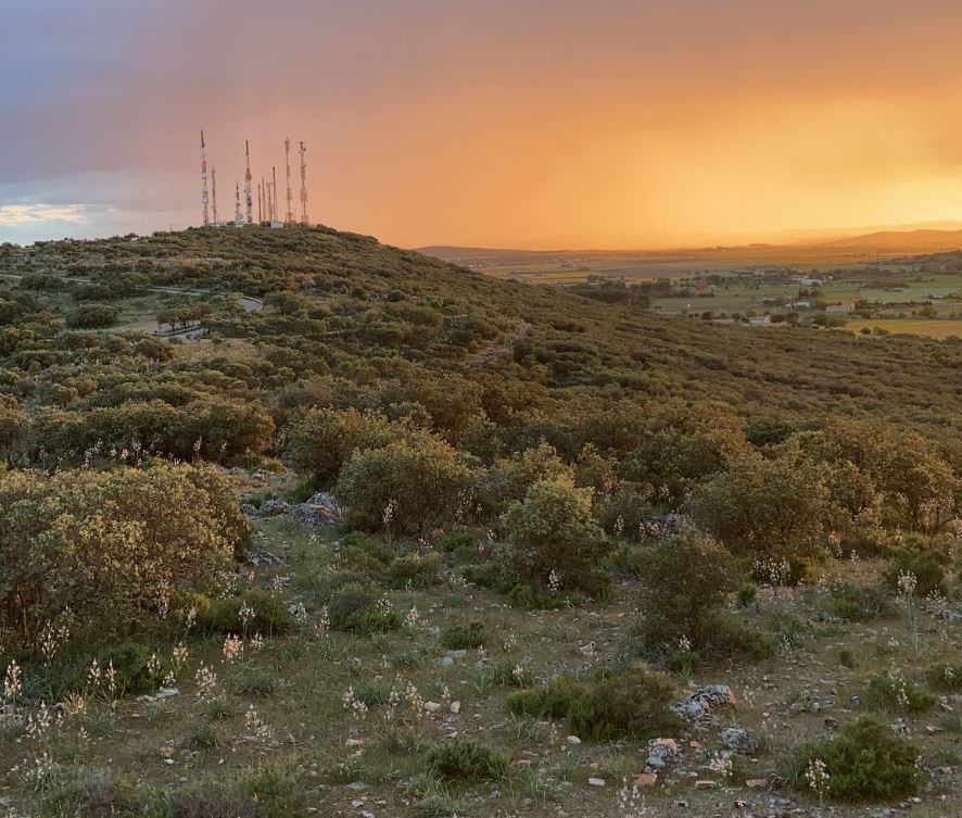
Human intervention in the western part has transformed the landscape, mainly by modifying or eliminating vegetation and introducing urban infrastructure. In addition, human activities linked to leisure have accelerated considerably in terms of diversity and development, generating a chaotic and disturbed space. On the other hand, the central and eastern part is well preserved with woody, bushy and herbaceous species close to the potential vegetation (holm oaks, broom, kermes oaks, kermes oaks, cress, rockrose, etc.).
On the other hand, La Atalaya is a panoramic setting for observing a wide variety of neighbouring landscape typologies, both general (urban, rural, natural and riverside landscapes) and specific elements that make up some of the landscapes of Castilla-La Mancha. From La Atalaya, you can observe elements of the Campo de Calatrava landscape (volcanoes, phreatomagmatic lagoons, hills); the landscape of La Mancha (plains, traditional crops, karst formations); the landscape of Montes de Toledo and Montes de Ciudad Real (sierras of Casalobos, Malagón, Villarrubia, etc.) and the landscape of the Vega de la Vega de la Calatrava (the landscape of La Vega de la Calatrava). ) and the landscape of the Vega del Guadiana, to the north of La Atalaya, differentiated by riverside vegetation and periodic water bodies.
How to arrive
On foot from University Campus through the Moledores Road: 3.9 km / 40 mins approx.
By car from Ciudad Real: 5 km / 11 mins approx.
CONTACT FOR INCIDENTS
CIUDAD REAL LOCAL POLICE TELEPHONE: 092
EMERGENCIES: 112
SUGGESTIONS AND INCIDENCES OF MAINTENANCE (Department of Sustainability and Agenda 2030- Parks and Gardens Section)
TELEPHONE: 926 216 877
EMAIL: JARDINES@AYTO-CIUDADREAL.ES